Difference between revisions of "310 260 22081"
Jump to navigation
Jump to search
(add category) |
(add identification) |
||
| Line 4: | Line 4: | ||
<gallery> | <gallery> | ||
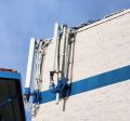
File:20230303_074850b Springs Community South East.jpg | File:20230303_074850b Springs Community South East.jpg|AT&T on the southeast side | ||
File:20230303_074908 Springs Community South East.jpg | File:20230303_074908 Springs Community South East.jpg|Sprint on the southeast side | ||
File:20230303_074935 Springs Community South.jpg | File:20230303_074935 Springs Community South.jpg | ||
File:20230303_074954 Springs Community.jpg | File:20230303_074954 Springs Community.jpg | ||
File:20230303_075128 Springs Community NW.jpg | File:20230303_075128 Springs Community NW.jpg|electrical on NW side | ||
File:20230303_075145 Springs Community NW.jpg | File:20230303_075145 Springs Community NW.jpg | ||
File:20230303_075214 Springs Community tower.jpg | File:20230303_075214 Springs Community tower.jpg|cell equipment in belltower | ||
File:20230303_075059b Springs Community NW.jpg | File:20230303_075059b Springs Community NW.jpg|electrical on NW side | ||
</gallery> | </gallery> | ||
Carrier identification thanks to u/thisisausername190 on [https://www.reddit.com/r/cellmapper/comments/11kinxx/carrier_identification_colorado_see_captions/ reddit] | |||
[https://www.google.com/maps/@38.9366929,-104.7624097,3a,75y,149.75h,103.77t/data=!3m6!1e1!3m4!1sgwh6lC4EC3sDRXC0u9ezYQ!2e0!7i16384!8i8192 Google Street View photos] has photos from September 2007 to September 2022. | [https://www.google.com/maps/@38.9366929,-104.7624097,3a,75y,149.75h,103.77t/data=!3m6!1e1!3m4!1sgwh6lC4EC3sDRXC0u9ezYQ!2e0!7i16384!8i8192 Google Street View photos] has photos from September 2007 to September 2022. | ||
Revision as of 04:51, 7 March 2023
This is a cell site at Springs Community Church at Lexington Dr and Woodmen Road.
These are photos that were taken March 3, 2023. The signs in one photo mention Rangewood and Dublin, but those are not the closest crossroads. There is cell equipment in the bell tower too.
Carrier identification thanks to u/thisisausername190 on reddit
Google Street View photos has photos from September 2007 to September 2022.
Physically at this site
- T-Mobile LTE eNB 22081 B2, B12, B66 (this page)
- T-Mobile LTE eNB 101348 B2
- T-Mobile GSM LAC 11029 NB 3466
- No T-Mobile B41 or B71
- No T-Mobile NR (as of March 3, 2023)
- AT&T LTE eNB 382057
Across the street: Verizon LTE eNB 16687
Permits/registration
PPR. Building department Plan: C166581
- Submitted 9/14/2022
FCC ARS 2671994
- constructed 07/30/2005


