Difference between revisions of "310 260 1060080"
Jump to navigation
Jump to search
(add info) |
(improve identification) |
||
| Line 1: | Line 1: | ||
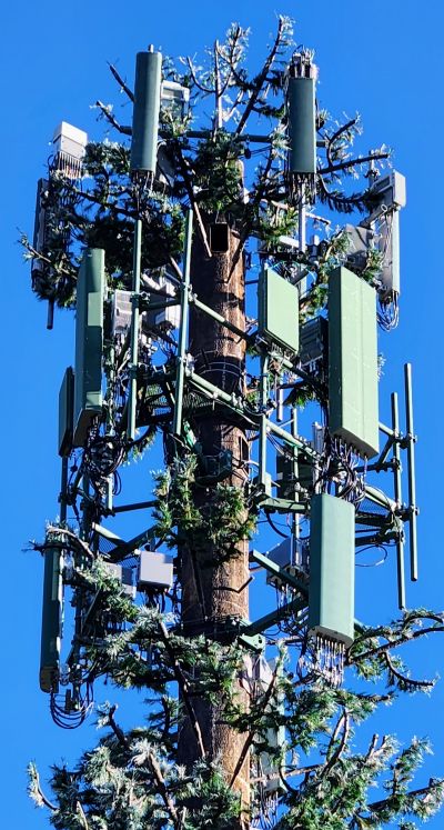
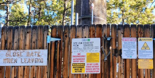
This is T-Mobile on a monopole on Rustic Oak Drive near Highway 83 and Old North Gate Road. | This is T-Mobile on a monopole on Rustic Oak Drive near Highway 83 and Old North Gate Road. | ||
The carriers on the top from top to bottom are (identification thanks to [https://www.reddit.com/r/cellmapper/comments/1202qd7/6_tower_ids_please_see_also_captions/ reddit discussion]): | |||
* Sprint | |||
* T-Mobile Nokia (with n41 + n71) | |||
* Dish | |||
== Photos == | == Photos == | ||
Revision as of 04:04, 24 March 2023
This is T-Mobile on a monopole on Rustic Oak Drive near Highway 83 and Old North Gate Road.
The carriers on the top from top to bottom are (identification thanks to reddit discussion):
- Sprint
- T-Mobile Nokia (with n41 + n71)
- Dish
Photos
Speed test
Google Fi, Galaxy S22, close range, March 2023
- NR NSA with 140 MHz N41: 684.04/62.02 Mbps, 65 ms: https://www.speedtest.net/result/a/9150920081
- NR NSA with 100 MHz N41: 431.66/86.00, 64 ms https://www.speedtest.net/result/a/9150899424
Permits and registration
- 2746 RUSTIC OAK GRV
- Issued 2013
- Issued 2021
- 2748 RUSTIC OAK GRV
- 2744 RUSTIC OAK GRV
- Issued 2022
- Dish based on date
- "This plan is for the T-Mobile installation addressed as 2748 Rustic Oak Grove"
- "The applicant has communicated that both Sprint and T-Mobile will continue to have installations at this site but did not clarify which installation is part of this submittal. The plan pages call this Sprint_Black_Forest but also say T-Mobile. Each installation has a different address and we need to know which installation is affected by this plan." (June 2021)

