Difference between revisions of "234 10 17072 104117"
Jump to navigation
Jump to search
(Added information about an unknown additional site) Tags: Mobile edit Mobile web edit |
(Changed information regarding O2 mast further up on the hill and added a picture) |
||
| Line 1: | Line 1: | ||
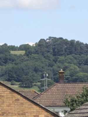
[[File:104117 Mast.jpg|thumb|alt=A picture of houses and telecommunications antennas on a pylon|Picture from Parkwood Crescent at 20x zoom, pylon with antennas shown in the distance]] | |||
Shared site between O2 and Vodafone on a pylon. | |||
O2 also broadcasts a 2G only signal further up on the hill, see 2G BTS 6541 (LAC 21491/21785). Not sure whether this will eventually carry 4G in some sort, covers part of the A38 towards Tewkesbury which struggles with signal. | |||
Revision as of 19:39, 17 July 2024
Shared site between O2 and Vodafone on a pylon.
O2 also broadcasts a 2G only signal further up on the hill, see 2G BTS 6541 (LAC 21491/21785). Not sure whether this will eventually carry 4G in some sort, covers part of the A38 towards Tewkesbury which struggles with signal.
