Difference between revisions of "311 480 20180"
Jump to navigation
Jump to search
m |
m |
||
| Line 1: | Line 1: | ||
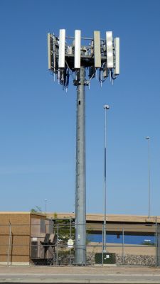
[[File:311_480_20180.jpg|225px|thumb|left|Seen with various Amphenol antennas and Nokia equipment (May 2022). Looking east.]]<br /> | [[File:311_480_20180.jpg|225px|thumb|left|Seen with various Amphenol antennas and Nokia equipment (May 2022). Looking east.]]<br /> | ||
Enterprise, NV: 36.068549, -115.182021<br /> | Enterprise, NV: 36.068549, -115.182021<br /> | ||
Built 9/2004<br /> | Built: 9/2004<br /> | ||
Height 48 ft.<br /> | Height: 48 ft.<br /> | ||
American Tower #412977 "I-15/Sunset NV"<br /> | American Tower #412977 "I-15/Sunset NV"<br /> | ||
