Difference between revisions of "234 10 21491 6541"
Jump to navigation
Jump to search
(Added information about site) |
m (Added 20x zoom image of the site) |
||
| Line 1: | Line 1: | ||
[[File:O2 Chosen Hill 2G Site on Street View.jpg|thumb|alt=Picture of two telecommunications towers from Google Street View and a Severn Trent Water facility|Shows picture of O2 site on the left and picture of shared EE and Three towers (as well as DAB+FM transmitters; used to broadcast Orange from around the mid 90s) on the right (Credit: Google Street View)]] | [[File:O2 Chosen Hill 2G Site on Street View.jpg|thumb|alt=Picture of two telecommunications towers from Google Street View and a Severn Trent Water facility|Shows picture of O2 site on the left and picture of shared EE and Three towers (as well as DAB+FM transmitters; used to broadcast Orange from around the mid 90s) on the right (Credit: Google Street View)]] | ||
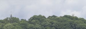
[[File:Orange Chosen Hill + O2 Chosen Hill Masts.jpg|thumb|alt=Two masts on a hill surrounded by trees|Picture from open field below (near some houses), EE+Three+FM/DAB site on left, O2 site on the right (taken at 20x zoom on a Google Pixel 6 Pro)]] | |||
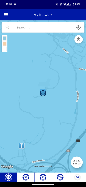
2G 900 only site for O2. No evidence to suggest Vodafone is on this site, constructed by O2 pre-Cornerstone (has to be before 2005 because judging by data on mastdatabase of sites in the area, this site shows up as MM02 MAST CHOSEN HILL, GLOUCESTER, GL3 2LG; wasn't able to find any planning applications either (I suspect the postcode displayed is wrong). Attached an image of masts in the area on O2 My Network for further evidence. | 2G 900 only site for O2. No evidence to suggest Vodafone is on this site, constructed by O2 pre-Cornerstone (has to be before 2005 because judging by data on mastdatabase of sites in the area, this site shows up as MM02 MAST CHOSEN HILL, GLOUCESTER, GL3 2LG; wasn't able to find any planning applications either (I suspect the postcode displayed is wrong). Attached an image of masts in the area on O2 My Network for further evidence. | ||
Latest revision as of 20:15, 7 July 2024
2G 900 only site for O2. No evidence to suggest Vodafone is on this site, constructed by O2 pre-Cornerstone (has to be before 2005 because judging by data on mastdatabase of sites in the area, this site shows up as MM02 MAST CHOSEN HILL, GLOUCESTER, GL3 2LG; wasn't able to find any planning applications either (I suspect the postcode displayed is wrong). Attached an image of masts in the area on O2 My Network for further evidence.
Site seems to only use this one ID based on information I've been given. 3G/4G is unavailable from this site, but eNB 104117 provides 3G 900 and 4G 800 + 2100. Thanks @RajSandhu2K for some of the information.


