Difference between revisions of "310 260 22342"
Jump to navigation
Jump to search
(add photo and "at this site") |
(add Dish permit) |
||
| Line 37: | Line 37: | ||
* Overall Height Above Ground (AGL): 98m / 322ft | * Overall Height Above Ground (AGL): 98m / 322ft | ||
== | == On this tower == | ||
* T-Mobile eNB 100993 | * T-Mobile eNB 100993 | ||
| Line 45: | Line 45: | ||
* AT&T eNB 382037 | * AT&T eNB 382037 | ||
* Sprint LTE eNB 543781 (formerly) | * Sprint LTE eNB 543781 (formerly) | ||
* Dish (permit [https://www.pprbd.org/Permit/Details?permitNo=O39297 O39297]) | |||
Revision as of 05:13, 12 February 2023
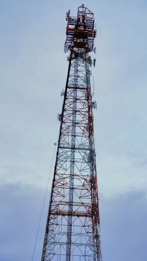
This is a large, rural cell site with multiple carriers, and this page is about T-Mobile.
Speed test
Speed tests taken on Marshbern Ct using a Samsung Galaxy S22 in February 2023:
- NR SA: n71 20 MHz + N41 40 MHz (3CA disabled on phone): 118/48 Mbps, 71ms (results)
- NR NSA: 355/92 Mbps, 66 ms (results)
PPRBD Permits
Permits for this location are listed on three streets. For more permits, see each permit and click through to "more at this address."
- 7113 MARSHBERN CT, COLORADO SPRINGS, CO, 80908
- June 2021
- CELL SITE MODIFICATION (T-MOBILE)
- Google Maps cannot find this address
- 39.04612160584426, -104.69443209386908
- June 2014
- 14755 BLACK FOREST RD, COLORADO SPRINGS, CO, 80908
- carrier not listed on permit page
- BACKUP GENERATOR FOR EXISTING CELL SITE
- Based on parcel, address is residential at 14625 WYANDOTT DR
- This house is next to tower 39.04612160584426, -104.69443209386908
FCC ARS
- Constructed 1959
- 14775 Black Forest Rd
- Overall Height Above Ground (AGL): 98m / 322ft
On this tower
- T-Mobile eNB 100993
- T-Mobile eNB 22342 (this page)
- T-Mobile NR 1064747 (?)
- T-Mobile GSM 3014
- AT&T eNB 382037
- Sprint LTE eNB 543781 (formerly)
- Dish (permit O39297)
