Difference between revisions of "310 260 34210"

From CellMapper Wiki
Jump to navigation Jump to search
m
Line 1: Line 1:
This tower is not the tower seen at 48th ave and Jackson street; the antennas on that wrong tower indicate Sprint, and to me, only legacy-Sprint at present, and some old unused antennas underneath.
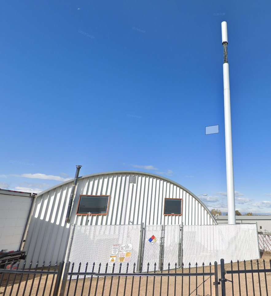
This eNB, is the "cantenna flagpole without a flag" next to the quonset hut building on Vasquez East at Beekman Pl.
AT*T is south across I-70.
All other carriers are further away, antenna racks not matching anything T-Mo has deployed so far.
TMO, this eNB, is the "cantenna flagpole without a flag" next to the quonset hut building on Vasquez East at Beekman Pl.
VZ is further southwest next to a school at 39th and Steele.


:[[File:ClipCapIt-201002-201521.PNG]]

Revision as of 05:01, 3 October 2020

This eNB, is the "cantenna flagpole without a flag" next to the quonset hut building on Vasquez East at Beekman Pl. All other carriers are further away, antenna racks not matching anything T-Mo has deployed so far.

ClipCapIt-201002-201521.PNG