Difference between revisions of "515 2 242188"
Jump to navigation
Jump to search
| Line 6: | Line 6: | ||
[[File:Cellsite Rooftop.png|thumb]] | [[File:Cellsite Rooftop.png|thumb]] | ||
See in [https://www.cellmapper.net/map?MCC=515&MNC=2&type=LTE&latitude=9.786117648222984&longitude=125.49710526152418&zoom=17.565508532494587&showTowers=true&showIcons=true&showTowerLabels=true&clusterEnabled=true&tilesEnabled=true&showOrphans=false&showNoFrequencyOnly=false&showFrequencyOnly=false&showBandwidthOnly=false&DateFilterType=Last&showHex=false&showVerifiedOnly=false&showUnverifiedOnly=false&showLTECAOnly=false&showENDCOnly=false&showBand=0&showSectorColours=true&mapType=roadmap&darkMode=false&imperialUnits=false eNB ID 342768] | |||
Revision as of 06:59, 18 November 2023
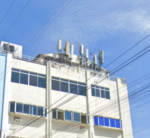
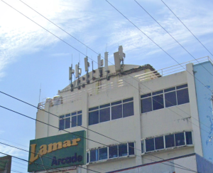
Globe Cellsite is Installed on the top of the Rooftop Building
Sector Antenna is installed in the each side of the building, broadcasting (LTE Band 1) (2100MHz), (LTE Band 3) (1800Mhz), (LTE Band 8) (900MHz), (LTE Band 28) (700MHz), (LTE Band 40) (2300MHz), and (LTE Band 41) (2500MHz) in different Cell ID
See in eNB ID 342768

