Difference between revisions of "310 260 1082323"
Jump to navigation
Jump to search
(add location info) |
(add FAA) |
||
| Line 8: | Line 8: | ||
* NR -55 dBm on 5/8/23 at 38.86224862,-104.72145111 (U-Haul) | * NR -55 dBm on 5/8/23 at 38.86224862,-104.72145111 (U-Haul) | ||
* GSM -51 dBm on 5/8/23 at 38.86223746,-104.72148289 (U-Haul) | * GSM -51 dBm on 5/8/23 at 38.86223746,-104.72148289 (U-Haul) | ||
== Regulatory == | |||
* FAA study [https://www.antennasearch.com/HTML/individual/nonregTower.php?faa_study_number=96-ANM-0013-OE 96-ANM-0013-OE]: constructed 1997 as Western Wireless Iii (T-Mobile) | |||
* FAA study [https://www.antennasearch.com/HTML/individual/nonregTower.php?faa_study_number=2005-ANM-1335-OE 2005-ANM-1335-OE] as T-Mobile | |||
[[Category:T-Mobile in El Paso County Colorado]] | [[Category:T-Mobile in El Paso County Colorado]] | ||
Latest revision as of 21:00, 10 February 2024
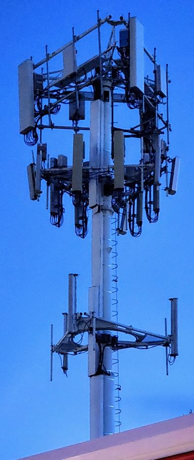
T-Mobile colocated on monopole at U-Haul Moving & Storage, 2175, Victor Place, Colorado Springs, El Paso County, Colorado, 80915, United States
Speed test: Galaxy S22 on Google at close range: 663.26/56.70 Mbps, 19 ms (results)
Do not confuse this with the nearby monopole 310_260_1080946. For 1082323 the strongest signals were:
- NR -55 dBm on 5/8/23 at 38.86224862,-104.72145111 (U-Haul)
- GSM -51 dBm on 5/8/23 at 38.86223746,-104.72148289 (U-Haul)
Regulatory
- FAA study 96-ANM-0013-OE: constructed 1997 as Western Wireless Iii (T-Mobile)
- FAA study 2005-ANM-1335-OE as T-Mobile
