Difference between revisions of "311 480 20187"
Jump to navigation
Jump to search
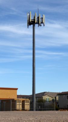
(Created page with "225px|thumb|left|Looking southeast.<br /> Enterprise, NV: 36.01936, -115.27827<br /> American Tower Site #412975 "Blue Diamond & Durango"<br /> FCC...") |
(Consolidated info, added radio bands.) Tags: Mobile edit Mobile web edit |
||
| (One intermediate revision by the same user not shown) | |||
| Line 1: | Line 1: | ||
[[File:311_480_20187.jpg|225px|thumb|left|Looking southeast.]]<br /> | [[File:311_480_20187.jpg|225px|thumb|left|Looking southeast.]]<br /> | ||
Enterprise, NV: 36.01936, -115.27827<br /> | Enterprise, NV: 36.01936, -115.27827<br /> | ||
Built 7/2004<br /> | Built 7/2004<br /> | ||
Height 85 ft.<br /> | Height 85 ft. | ||
Verizon | |||
American Tower #412975 "Blue Diamond & Durango"<br /> | |||
FCC reg. 1010743 | |||
Verizon LTE b2,13,66/CDMA BC0 | |||
